and 300 feet E-SE is approximately N46 09.949 W083 08.224
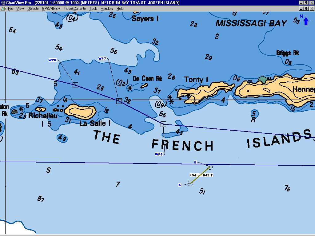
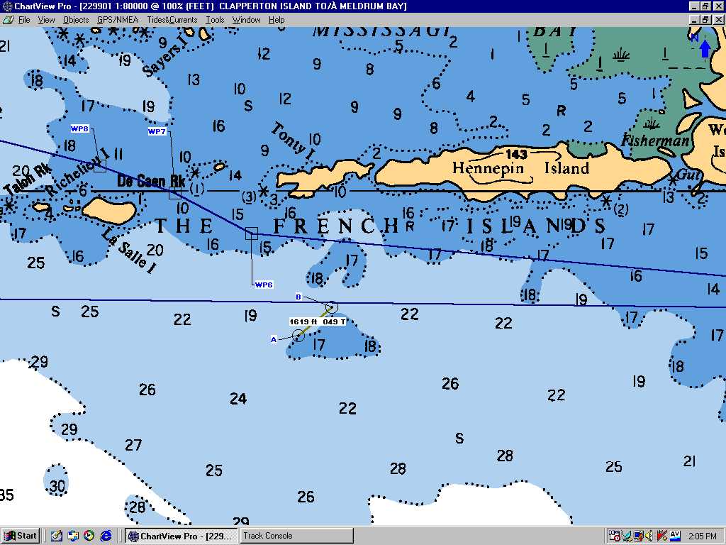
In the summer of 2005 we were motoring in a westerly direction, south of the French Islands, into a 25 knot wind under crystal clear skies at 0930. Instead of our primary route out of Blind River to Drummond Island, we switched to an alternate route closer to the north shore for a smoother ride. In the meter chart 225101 the light blue should be between 5 and 10 meters and the first dark blue should be between 2 and 5 meters. The dotted couture line looks like it indicates 0 to 2 meters. We hit near the spot where the chart indicates 3.2 meters and roughly 200 meters from the closest dotted line 2 meter couture line. We did not get into Mississagi Bay and were able to retrace our steps to get out of the mess and get back on the southern route.
We had two Garmin, GPS-12’s, both were in the “3D NAV” mode so they had at least four satellites. Both indicated that we were just short of waypoint 7 and very near to the center of the route. I think we were about 300 feet E-SE of the waypoint 7. In the past when I have taken these two GPS’s to geodetic markers they have always read to within +/-1 of the least significant digit for the marker (+/- 6 feet). Visually, I was halfway between the two points of land (LaSalle Island and De Caen Rock). Closer examination of the damage to the lead keel revealed that there may be a 2.5" diameter cable down there at 4 feet in addition to the gigantic boulders or rock formation at 5 feet.
Waypoint 7’s coordinates are
N46 09.984 W083 08.279
and 300 feet E-SE is approximately N46 09.949 W083 08.224
I should download the latest 229901 and the latest 225101 chart, but I have not found where the free updates are available.
Revised
November 20, 2005 .